
The data
and AI infrastructure
of Brazilian agriculture
AgriSafe connects field agents, satellites and credit bureaus in a single platform. Our AI turns every farm visit and every field into decision intelligence for agribusiness manufacturers, distributors and financial institutions.
Artificial intelligence at the core of the platform
At AgriSafe, AI is not an add-on feature. It runs on an asset no generic model has: proprietary field data, enriched with satellite imagery, weather and credit.
Farm intelligence engine
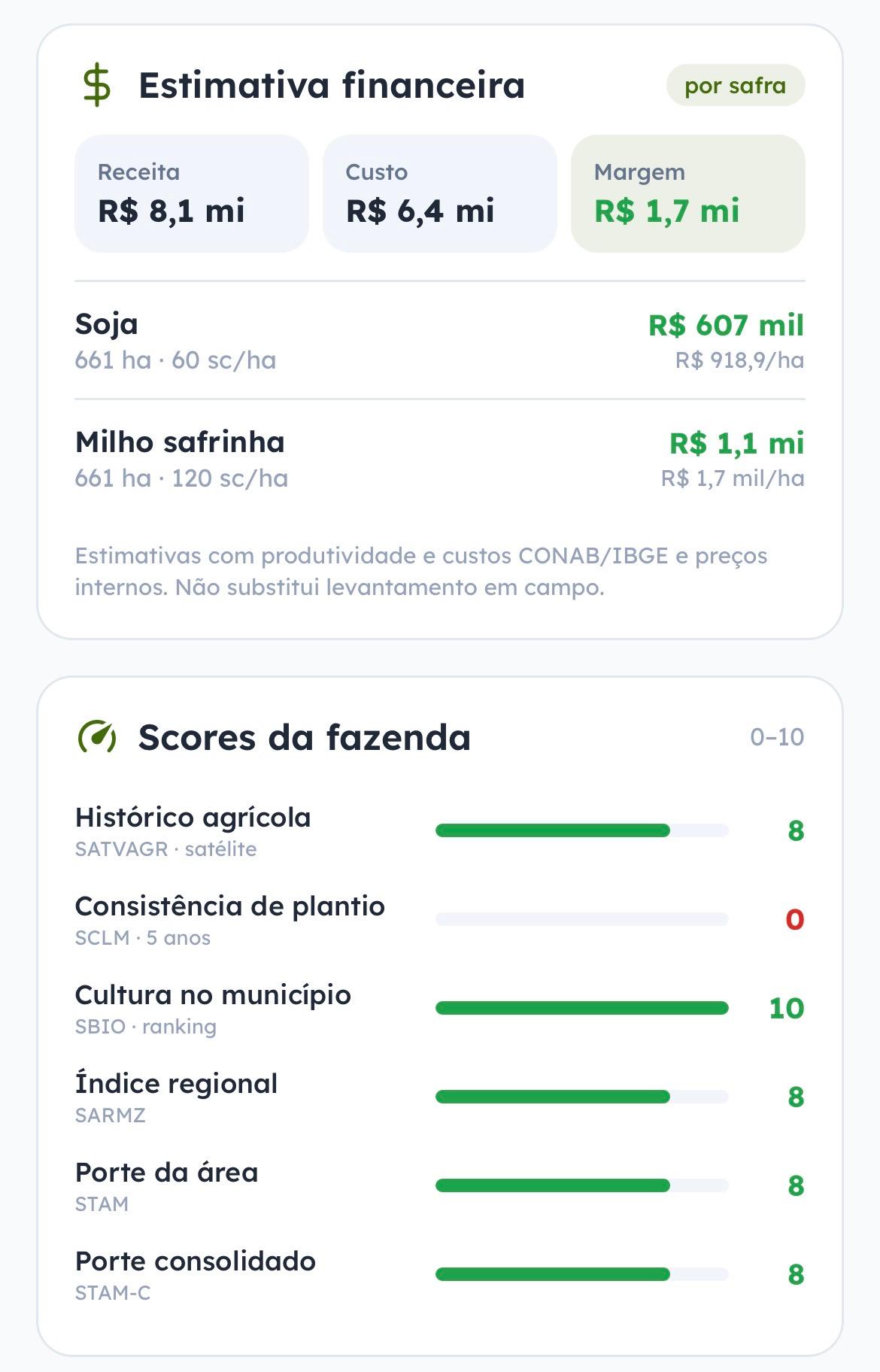
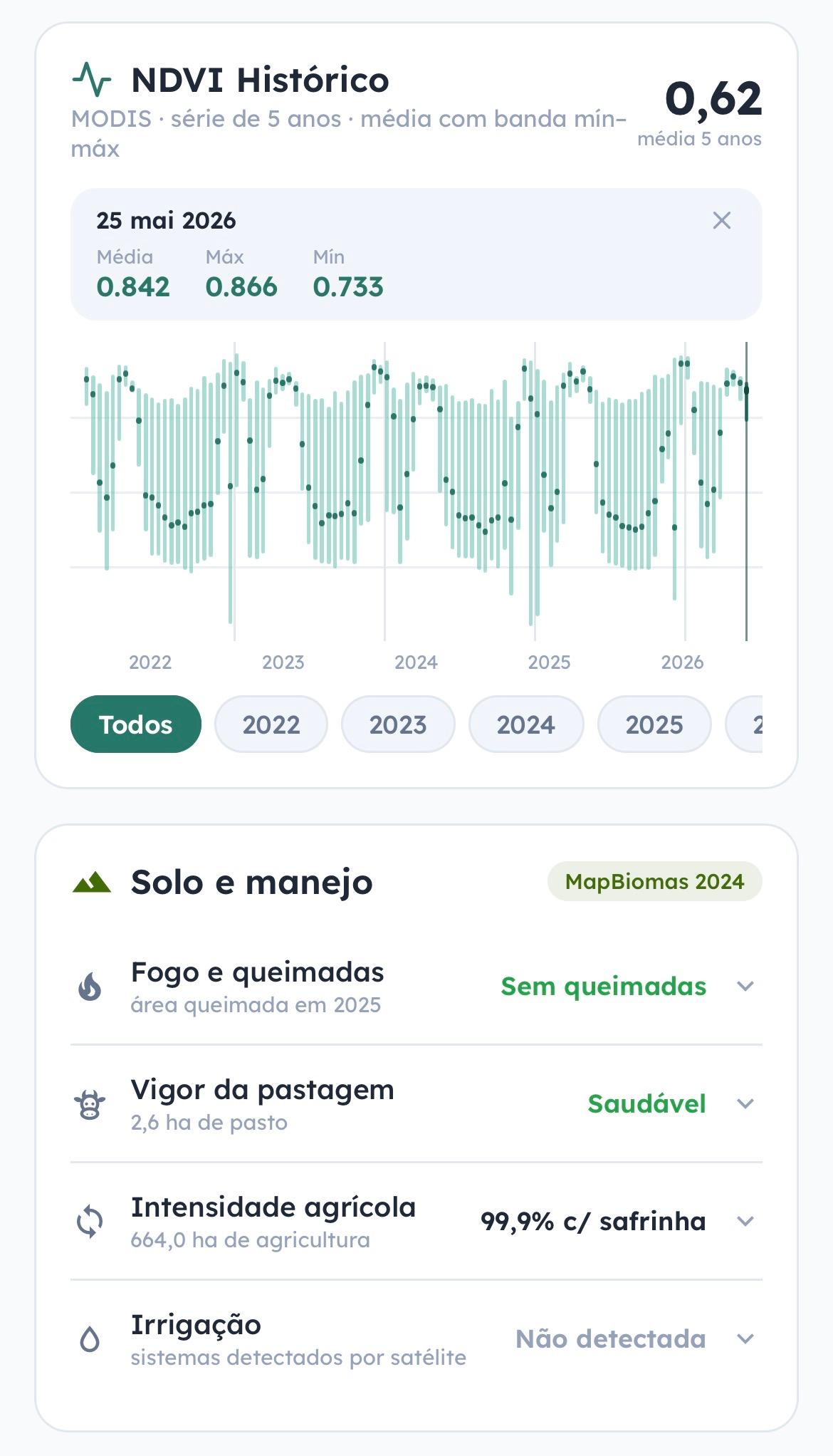
Our geospatial engine processes Sentinel-2 and MODIS imagery, MapBiomas land-use data and historical NDVI series to build the complete dossier of every farm: agronomic scores, crop intensity, irrigation, fire events and revenue and margin estimates per season.
- Revenue, cost and margin estimates per crop
- Agronomic scores from 0 to 10 per farm
- 5-year NDVI history and land cover
- 16 automated socio-environmental checks
AI-generated reports
For every query, the platform writes the analysis in executive language: credit portfolio x-rays, CPR maturity alerts, score drops with the cause named and a recommended next action. All generated by AI and auditable by humans.
- Portfolio x-ray in one click
- Early-warning risk alerts
- PDF export for credit committees
A data flywheel that compounds
The more the platform is used, the smarter it gets, and the more valuable every next decision becomes.
Field
Agents log georeferenced visits, photos and orders, even offline
Data
Every record is enriched with satellite, weather, land registry and credit bureaus
AI
Farm Intel turns the data into analyses and recommendations
Decision
Credit, sales and monitoring decided on evidence, and every decision feeds the cycle
One platform, from field to credit
A web platform for the office, an offline-first app for the field, and AI across every layer. The office and the field, one team.
Credit & Risk
Agro credit bureau with AI analysis
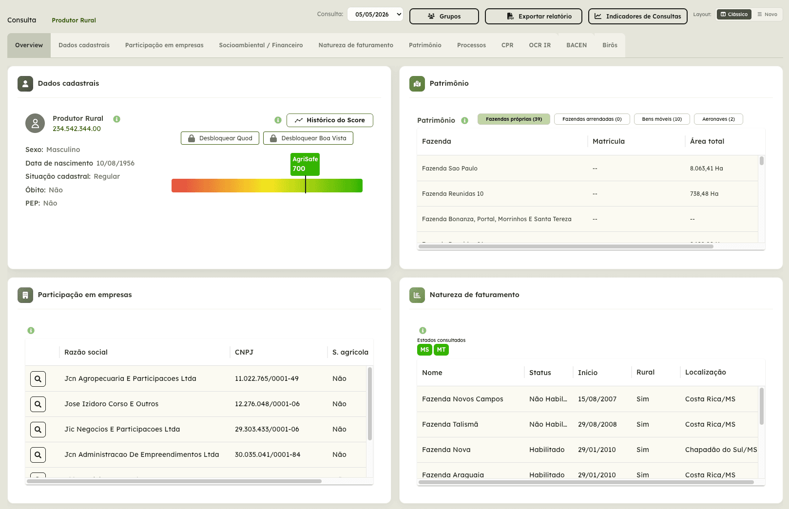
A complete rural producer analysis in a single query: proprietary score across 7 dimensions, assets and farms with land registry (CAR), registered CPRs, protests, lawsuits and socio-environmental checks.
The problem:
Assessing a producer means gathering dozens of sources, and the snapshot ages fast, leaving collateral and portfolios unwatched.
Our solution:
One query gathers 160+ attributes per producer, with an AI-written analysis and continuous monitoring of the portfolio and its collateral.
Key capabilities:
- 160+ attributes per producer in one query
- Farms and assets mapped via land registry (CAR)
- Multiple credit bureaus queried simultaneously
- Early warning on collateral before maturity
- Compliance-ready for expected-loss regulation (CMN 4.966)
Value delivered:
Proprietary score across 7 dimensions
An algorithm built for agribusiness, combining financial, asset and agronomic data
Automated socio-environmental checks
16 checks per farm: embargoes, indigenous lands, deforestation and more
CPR management and monitoring
Registration, collateral and maturity alerts tracked in one place
AI-generated portfolio x-ray
An executive report of the entire portfolio, generated by AI and exportable to PDF
Built for agribusiness decision-makers
The same data and AI infrastructure, applied to decisions across the value chain.
Input manufacturers
Productive field teams, governed orders and territory intelligence
Distributors and dealers
Visible pipeline, safe credit and clients monitored by satellite
Financial institutions
Agro credit bureau, collateral monitoring and AI portfolio x-rays
Cooperatives and originators
Producer dossiers, mapped storage and risk alerts
Start running lookups today.
Create your account in minutes and run your first rural property analysis on us. Agri credit bureau and a full farm x-ray, no monthly fee and no contract.
CREDIT BUREAU
Agri credit bureau
Full producer profile by tax ID: registration, companies, lawsuits, social-environmental status and land holdings, consolidated into a credit score with a verdict ready to decide.
FARM LOOKUP · 🌱 1st free
Rural property x-ray
Enter the CAR code and get the full picture of the farm: what could block the deal (embargo, deforestation, overlap), what the land is and produces, and how much it's worth. The first one is on us.
- Buy credits and use them anytime
- Instant results
- Credits valid for 12 months
- Score and verdict ready to decide
- From producer lookup to farm analysis
Already have an account? Log in
Farm Lookup: one complimentary analysis per company. Bureau: pay-as-you-go, you only pay for what you look up.
What AgriSafe delivers
Four fronts built on the same assets: proprietary field data, satellite imagery, credit data and an AI layer that turns it into decisions.
Collateral Management
From registration to perfection, with an auditable report
A single pipeline for real estate collateral pledged in credit operations: title registration, legal review, appraisal, approval and perfection. Every transition is written to an immutable audit trail and, once perfected, the collateral stays under satellite monitoring.
- Multi-role pipeline with SLAs and automatic deadline alerts
- Versioned technical report with satellite, land use and socio-environmental checks
- Immutable audit trail: list, dashboard and export always reconcile
- Living collateral: alerts when reality in the field diverges from the report
- Aligned with Brazilian expected-loss and remote-sensing regulation (CMN 4.966 and 5.267)
Credit Origination in the Field
For those who finance the rural producer
Anyone selling inputs on credit, financing infrastructure inside the farm gate or originating grain carries multi-season risk on the producer. We deliver three layers in sequence: map the eligible universe, assess capacity to pay, and track contract and collateral through settlement.
- Mapping by farm size, crop and infrastructure (irrigation, storage)
- Cross-referencing land registry, water permits, embargoes and deforestation
- Batch credit screening and individual dossiers with a proprietary score
- Mark-to-market of barter and CPR contracts
- Crop and collateral tracking with satellite imagery every 4 days
Field Sales Operations
From territory planning to invoiced order
The field team plans the territory, logs visits, builds the order with regional pricing and approves it by authority level, all in an app that works offline and talks to the company's ERP. The approved order flows to invoicing with no re-keying.
- Territory management plans with per-rep schedule adherence
- Orders with regional price lists and PDF proposals under your brand
- Approval chain by authority level, from rep to director
- Master contracts with running balance and invoicing by HQ or branch
- Integration with the company's ERP: master data, credit limits and price lists
Economic Groups
Real risk is not in the isolated taxpayer ID
Lending to five entities owned by the same person is a single exposure. Starting from one query, the analyst assembles the economic group from related people and corporate holdings and gets a consolidated report, with no average to hide the weakest link.
- Group assembly from related people and corporate holdings
- Score per member, ranked from worst to best
- Socio-environmental status set by the group's weakest link
- Assets, CPRs, protests and lawsuits consolidated
- Death and kinship alerts to review ownership and collateral
Built on state-of-the-art technology
AgriSafe processes geospatial data on Google Earth Engine, runs on Google Cloud and uses Gemini models via Vertex AI, combined with official sources and proprietary field data.
Google Earth Engine
Planetary-scale geospatial processing
Google Cloud & Vertex AI
Infrastructure and Gemini models powering the AI analyses
Sentinel-2 & MODIS
Satellite imagery with a 4-day average revisit
MapBiomas
Land use and cover with historical series
CAR / SICAR
Polygons and areas of every rural property
CPR registrars
Registered agribusiness receivables and notes
Credit bureaus
Scores, protests and lawsuits in one query
SICARM / CONAB
24,000+ grain storage units mapped
Integrated Ecosystem
Manufacturers, distributors, cooperatives and financial institutions use AgriSafe to sell, finance and monitor agribusiness with data and AI.
Companies that already use our solution















Proven Results
Our network of clients and partners proves daily the value of deciding with field data, satellite imagery and artificial intelligence.
Productive field teams
Dossiers before visits and frictionless logging raise team utilization
Risk anticipated
Satellite monitoring and early warnings alert before the loss
Credit with evidence
Proprietary scores and AI analysis back every limit decision
Integrated with your ERP
Approved orders flow straight to invoicing in your system
Join Our Ecosystem
Join the companies already deciding with field data, satellite imagery and AI. Let's connect your operation to the future of agribusiness.
Schedule your Demo
See AgriSafe's platform and AI in action with data from your region. Fill out the form and our team will get in touch.